Alertes en vigueurAtlanta, LA
If outdoors, consider seeking shelter inside a building.These storms may intensify, so be certain to monitor local radiostations and available television stations for additional informationand possible warnings from the National Weather Service.A Severe Thunderstorm Watch remains in effect until 100 AM CDT fornorth central Louisiana.
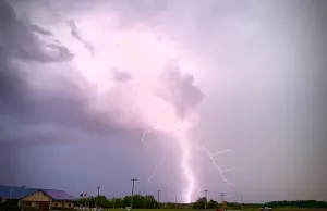
At 1113 PM CDT, Doppler radar was tracking strong thunderstorms alonga line extending from 8 miles southeast of Ruston to 18 milesnorthwest of Olla to 11 miles south of Winnfield. Movement was eastat 40 mph.HAZARD...Wind gusts up to 50 mph.SOURCE...Radar indicated.IMPACT...Gusty winds could knock down tree limbs and blow aroundunsecured objects.Locations impacted include...Monroe, Winnfield, Jonesboro, Columbia, Brownsville-Bawcomville,Jena, Richwood, Olla, Clarks, Grayson, Midway, Urania, Chatham, NorthHodge, Tullos, Dodson, Georgetown, East Hodge, Atlanta, and Eros.
For your protection move to an interior room on the lowest floor of abuilding.
At 1117 PM CDT, severe thunderstorms were located along a lineextending from near Montgomery to 6 miles north of Flatwoods to 6miles northwest of Hutton, moving southeast at 55 mph. These stormscontinue to quickly weaken, and the warning may be cancelled early.HAZARD...60 mph wind gusts.SOURCE...Radar indicated. Trees have been blown down across Western andCentral Natchitoches Parish with these storms.IMPACT...Expect damage to roofs, siding, and trees.Locations impacted include...Natchitoches, Montgomery, Natchez, Cloutierville, Melrose, Flora,Cypress, Bellwood, Chopin, Bermuda, St. Maurice, and Gorum.